Functional classification is the process by which streets and highways are grouped into classes based on the type of service they are intended to provide. The classes are used by federal, state, and local governments to determine jurisdictional responsibility, allocate funds, and establish design standards. Within urban areas, streets can be classified as interstate, freeway/expressway, principle arterial, minor arterial, major collector, minor collector, or local road. Streets classified as minor collector and higher are eligible for federal funds for maintenance, expansion, and safety improvements.
Following each decennial census, states and metropolitan areas develop smoothed urban area boundaries (UAB) based on the urbanized area designations provided by the U.S. Census Bureau. Following the approval of the 2010 UAB, states and MPOs are required to update the functional classifications of roadways throughout the state utilizing the new urban area boundaries as the demarcation between urban and rural areas. After the Oklahoma City UAB was approved in May 2013, ACOG staff started working on updates to the functional classification system.
In order to determine which roads were to be updated, ACOG staff looked at traffic counts, activity centers, and future plans for all of the roads within the Oklahoma City Area Regional Transportation Study (OCARTS) area. Those roads in which conditions had changed were suggested to be updated to an appropriate classification. These “update suggestions” were added to a shapefile with details about each road. All of the update suggestions were uploaded to an ArcGIS Online map which showed the current functional classification and updates suggested by ACOG.
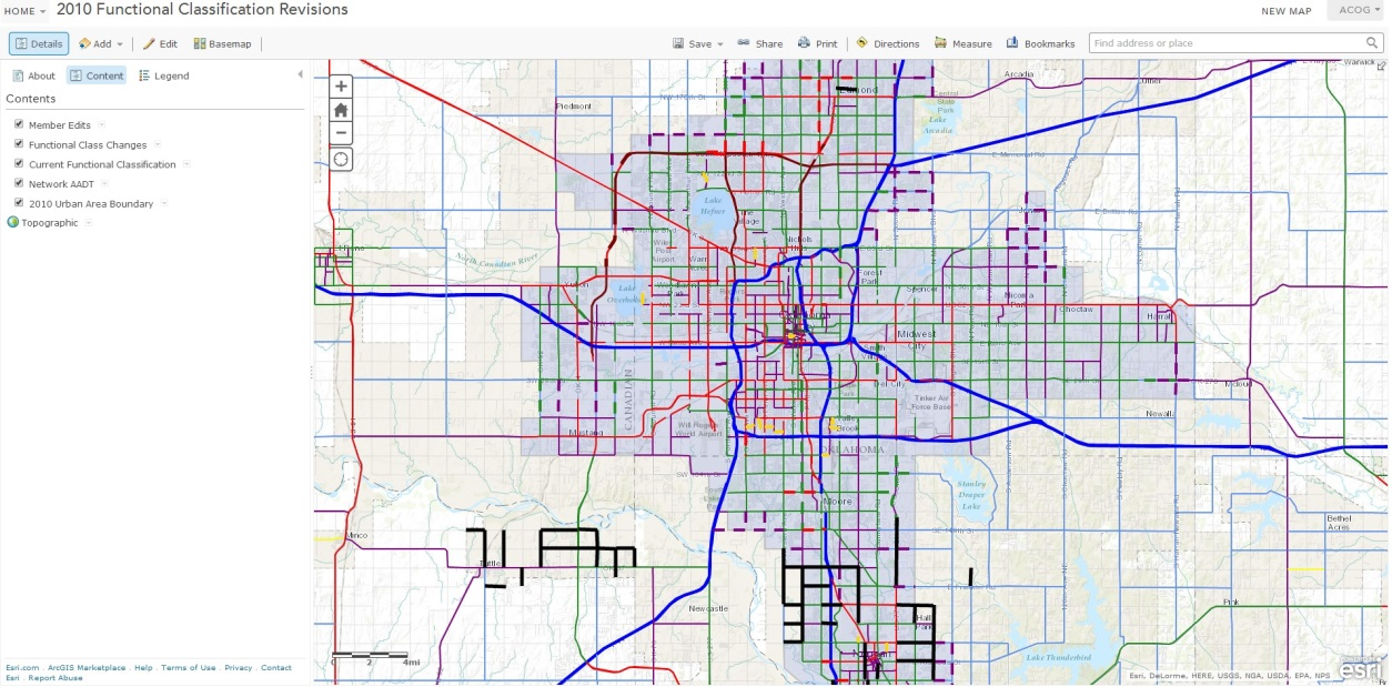
Click here for the interactive ArcGIS Functional Classification map
The map was then sent to the entities within the OCARTS area with instructions on how to edit the map. Our hope was that instead of holding meetings with each entity, they would be able to identify on the map the sections of roads within their community that needed to be modified. Editors were able to designate the sections of roads to be updated and then enter specific details about the road. ACOG also asked for information on who made the edit, what entity they were representing, the name of the road, and the suggested update.
The member staff persons were able to see the update suggestions made by ACOG staff. If they felt any of the update suggestions were not appropriate, they could contact ACOG for further discussion.
ArcGIS Online was not without its flaws, however. A few city staff members had trouble accessing the map due to filters on their web browsers, outdated software which couldn’t process the map, or bandwidth restrictions that didn’t allow the map to load properly. These individuals had to send their update suggestions to ACOG staff via email or over the phone. However, this did not cause much of a problem because these entities had minimal update suggestions.
In the end, the ArcGIS Online map was a great help in the process of updating the functional classification system. It allowed everyone to see the current classifications and zoom into the specific parts they were interested in. Without this technology, staff would have had to create individual maps for each entity and hold meetings in order to update the functional classification of their roads. The ArcGIS Online maps allowed all the entities to see what is happening in other parts of the region and any changes made to the map could be viewed in real time. These benefits allowed ACOG staff to be more efficient in the process of recommending updates to the federal functional classification system.
Now that all of the desired updates to the OCARTS area functional classification system have been approved by ACOG’s transportation committees, the MPO has provided the full list of recommendations to the Oklahoma Department of Transportation for review and final approval by the Federal Highway Administration.